
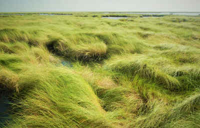
Wetland Delineations and Permitting
Benchmark biologists are experienced in providing field assessments for wetlands and Jurisdictional Waters of the United States. We provide permitting services required by Sections 401 and 404 of the Clean Water Act and Section 10 of the Rivers and Harbors Act. All delineations of Jurisdictional Waters of the United States are performed in accordance with the 1987 USACE Wetland Delineation Manual and the appropriate regional supplement.
 Benchmark has conducted habitat mapping and wetland delineations on over ten thousand acres, supporting pipeline and powerline right-of-ways; mitigating site evaluations, housing developments, industrial site development projects including: airports, LNG facilities, dredge impoundments, container terminals and barge terminals.
Benchmark performs wetland functional assessments including iHGM (USACE Galveston District), TXRAM (USACE Fort Worth District), Charleston, WVAM, UMAM and many others. Wetland functional assessments are an important key to scoring wetlands across a wide range of factors to develop functional credit units that can be purchased from area mitigation banks.
Planting Plans and Field Support
Benchmark scientists have developed planting plans and provided field support for the planting of over one million wetland plants for industrial clients such as; US Army Corps of Engineers, Texas Parks & Wildlife, school districts, development companies and port authorities. 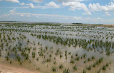 Recent planting projects include tidal wetlands consisting of Smooth Coordgrass (Spartina alterniflora), marsh hay (Spartina patens), and sea grasses. Freshwater impoundments planted by Benchmark contain a mix of native species including California bulrush (Schoeneoplectus californicus) and Broadleaf arrowhead (Sagittaria latifoli).
Areas planted by Benchmark have met or exceeded their success criteria and project goals, as well as long term sustainability of the sites. Benchmark offers the front end planning and field work capabilities to complete a planting project from start to finish.
Design to Support Mitigation and Restoration Projects
Benchmark scientists and GIS analysts develop conceptual designs for wetland restoration and mitigation projects. Our designs have been used to construct and plant over 150 acres of wetlands on some of the largest wetland construction and mitigation projects along the Texas Gulf coast.
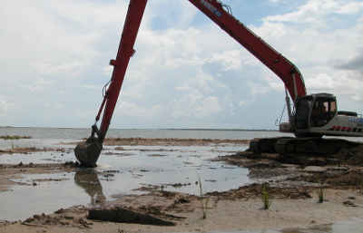
Benchmark has conducted preliminary wetland investigations for proposed mitigation sites and species diversity studies for beneficial us projects located along the Texas Gulf Coast.
Benchmark provides biological and ecological oversight of wetland construction and restoration projects. Scientists work with engineers and construction contractors to build habitats that will be suitable for rapid wetland development and long-term growth.
Special considerations are given to wetland elevations and species tolerance. This helps to develop a wetland restoration plan that can succeed on it’s own well into the future. Benchmark works with survey crews and engineers to design projects that will work correctly the first time.
Wetland Mitigation Monitoring
Once wetlands have been constructed, Benchmark scientists develop and conduct monitoring studies to document the growth and success of the wetland. Monitoring plans are developed in the initial stages of project planning and are often approved by the USACE.
Mitigation monitoring is usually conducted for 5 years prior to the completion of a permitted project to document any changes. Both positive and negative changes are documented for the mitigation sites. Sites are considered complete if they meet their intended success criteria at the end of the monitoring schedule.
Benchmark gathers all the necessary field data and compiles a report suitable for review by state and federal agencies to determine mitigation compliance.