
When permitting a marine construction project (e.g. pipeline, terminal construction or expansion, etc.), benthic surveys are conducted to identify and map sensitive habitats including oyster reefs. When impacts to sensitive habitats are unavoidable, mitigation for the impacted areas is likely. The process for delineating and quantifying oyster habitats along the Texas Gulf Coast is a two step process and is described below.
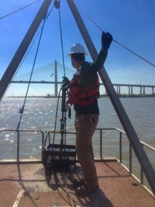 Benthic surveys are conducted first to delineate and map oyster shell and oyster reef boundaries within work zones and an additional 500 ft. buffer immediately adjacent to work zones. Based on protocols developed by the Texas Department and Wildlife Department (TPWD), oyster shell and reefs are delineated using side scan sonar in water depths greater than 2.5 feet, and probing, wading, and/or visual surveys are conducted in water depths less than 2.5 feet.
Benchmark biologists conduct oyster delineation surveys using state of the art sonar equipment and custom survey boats designed to work in deep or shallow water. Benchmark GIS analysts use field survey data to develop maps showing locations and boundaries of oyster habitats.
A qualitative/quantitative survey is conducted following the benthic survey to characterize oyster habitat to comply with TPWD protocols for permit applications. TPWD encourages the use of patent tongs to collect grab samples at a distribution rate of four grabs per acre. Benchmark fabricated two sets of custom patent tongs consistent with TPWD sampling specifications. The hydraulic-powered tongs efficiently grab benthic samples, and grab samples are brought aboard Benchmark sampling vessels where oysters and other benthic organisms are identified, counted, measured, and photographed. The data is collected to support mitigation considerations and provides information on reef health and condition.
Call Neil Henthorne (281 934-3403, ext. 113) to learn more or to provide field and permitting support for your marine project.