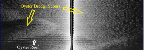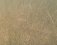
Benchmark provides unique services to support permitting for projects where oyster habitat, submerged aquatic vegetation, and/or other sensitive benthic habitats may be impacted. Services include the use of low frequency (LF) sonar, side scan sonar (SSS), patent oyster tongs, unmanned aerial vehicles (UAV), divers, and underwater remotely operated vehicles (ROV). These services allow Benchmark biologists to confirm the presence or absence of sensitive habitats. If sensitive habitats are identified, Benchmark can delineate habitat boundaries and conduct quantification surveys suitable for presenting to state and federal agencies to support permit applications and, if necessary, mitigation.
Hydrographic Surveys
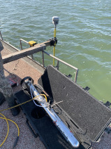
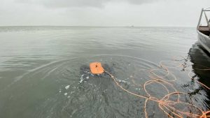
Hydrographic surveys provide an invaluable source of data to support marine studies. Benchmark conducts sonar-based surveys employing a variety of methods and technologies to appropriately investigate conditions beneath the water’s surface. Side scan, single beam, sub-bottom, and Acoustic Doppler Current Profiling (ADCP) technologies are employed to collect a variety of datasets in support of dredging projects, submerged habitat delineation and conservation, and contaminant dispersal determinations. A robust understanding of geographic and vertical datums as well as acoustic physics is paramount to the success and integrity of our surveys.
-
Bathymetric Surveys
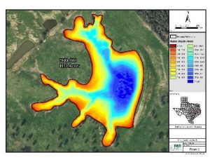
Bathymetric surveys measure submerged features and sediment elevations to calculate water depths and volumetric cuts to support engineers, researchers, and scientists. Before marine construction or dredging operations can begin, bathymetric surveys are conducted to map the surface of submerged sediments. Benchmark has conducted bathymetric surveys to support numerous projects including beach erosion studies, marine infrastructure construction, frac water sourcing, pipeline trenching, and maintenance or new work material dredge events.
Seagrass Surveys
The Texas Gulf Coast is home to five species of seagrass. Collectively, seagrass species are referred to as submerged aquatic vegetation (SAV) and are protected by 2013 Texas legislation which prohibits the uprooting of seagrass. Benchmark is adept at using several remote sensing methods to survey seagrass beds with zero disturbance to the sensitive habitat. Applications may use unmanned aerial vehicles (UAVs) or underwater remotely operated vehicles (ROVs) to map seagrass presence without intrusion. Extensive, high-density, datasets are collected in-situ during SAV surveys following the most recent SAV survey protocols developed by Texas Parks and Wildlife Department (TPWD). Benchmark biologists work closely with TPWD personnel when conducting SAV surveys.
TPWD protocols are documented in the “Recommended Survey Protocols for Estuarine Submerged Aquatic Vegetation (SAV) For Permitting and Introduction Applications”. Commonly followed protocols include: Survey Timing and SAV Survey Data Collection Techniques.
Oyster Surveys
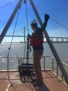
Benchmark offers shallow and deep-water side-scan sonar services which are employed to efficiently map oyster habitat and viable reefs. Once oyster habitat has been mapped and delineated in Texas waters, Benchmark uses custom oyster patent tongs to collect surface grabs for quantification purposes. In Louisiana waters, Benchmark uses divers to conduct quantification surveys. Click here to learn more about oyster patent tongs and recent oyster surveys.
Benchmark follows all TPWD protocols documented in “Recommended Survey Protocols for Oyster Habitat for Permitting Review of Pipeline Installation Project in Deep Waters (>2.5 feet)”. Protocols include side scan survey specifications, sub-bottom profiler specifications, bathymetric survey specifications, quality assurance measures, hard bottom verification procedures, and report documentation.
